Horton Plains National Park is a protected area in the central highlands of Sri Lanka and is covered by montane grassland and cloud forest. This plateau at an altitude of 2,100–2,300 metres (6,900–7,500 ft) is rich in biodiversity and many species found here are endemic to the region. This region was designated a national park in 1988. It is also a popular tourist destination and is situated 32 kilometres (20 mi) from Nuwara Eliya.
The Horton Plains are the headwaters of three major Sri Lankan rivers, the Mahaweli, Kelani, and Walawe. In Sinhala the plains are known as Maha Eliya Plains. Stone tools dating back to Balangoda culture have been found here. The plains' vegetation is grasslands interspersed with montane forest, and includes many endemic woody plants. Large herds of Sri Lankan Sambar Deer feature as typical mammals, and the park is also an Important Bird Area with many species not only endemic to Sri Lanka but restricted to the Horton Plains. Forest dieback is one of the major threats to the park and some studies suggest that it is caused by a natural phenomenon. The sheer precipice of World's End and Baker's Falls are among the tourist attractions of the park.
History
The original name of the area was Maha Eliya Thenna (මහ එළිය තැන්න - "great open plain"). But in the British period the plains were renamed after Sir Robert Wilmot-Horton, the British governor of Ceylon from 1831 to 1837,
Sir Joseph Dalton Hooker had advised the British Government "to leave all Montane Forests above 5000 ft. undisturbed" and an administrative order to this effect had been issued in 1873 that prevented clearing and felling of forests in the region. Horton Plains was designated as a wildlife sanctuary on 5 December 1969, and because of its biodiversity value, was elevated to a national park on 18 March 1988. The Peak Wilderness Sanctuary which lies in west is contiguous with the park. The land area covered by Horton Plains is 3,160 hectares (12.2 sq mi). Horton Plains contains the most extensive area of cloud forest still existing in Sri Lanka.
Bakers Fall
Baker's Falls is a famous waterfall in Sri Lanka. It is situated in Horton Plains National Park on a tributary of the Belihul Oya. The height of the Baker's waterfalls is 20 metres (66 ft). The falls were named after Sir Samuel Baker, who was a famous explorer. Many Rhododendron and Fern
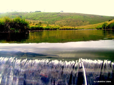
pictures of the bakers falls , Horton Plains .
Plantation
The vegetation of the park is classified into two distinctive groups, 2,000 hectares (7.7 sq mi) of wet patana (Sinhalese for "montane grasslands") and 1,160 hectares (4.5 sq mi) of subtropical montane evergreen forests.Nearly 750 species of plants belonging to 20 families have been recorded from the park. The forest canopy reaches the height of 20 metres (66 ft).
Frequent fire and grazing characterises Plagioclimax communities of the grassland flora. Waterlogged swamps or slow moving streams are found in low lying areas,
Tree trunks and branches are ornamented with many species of ferns, Old man's beard (Usnea barbata) hanging from branches adds to the beauty of the forests. About 16 of the orchid species being endemic. Other notable plants include shrubs. rost and soil erosion.bushes can be seen around the waterfall.
ost - WIKIPEDIA


Comments
Post a Comment